.jpg)

Alliance Forum Addresses Multiple Issues
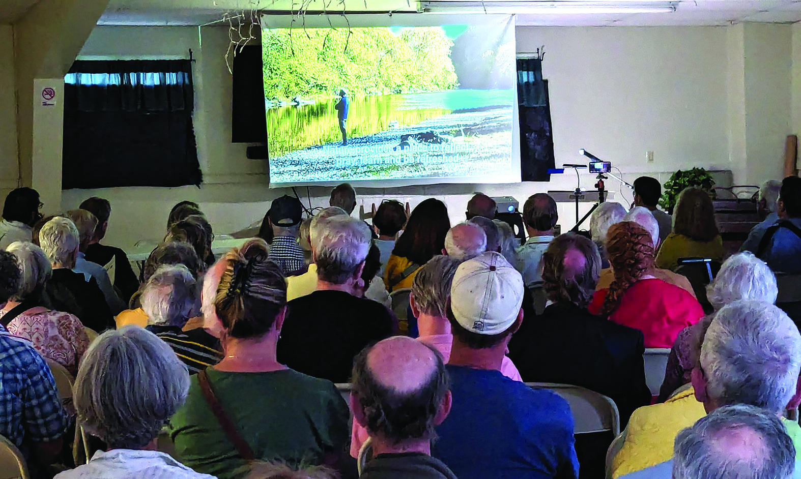
Several dozen citizens gathered in the Rockbridge Baths firehouse last Tuesday to hear from members of the newly formed Maury River Alliance and several others about the history of the Goshen dam and Lake Merriweather, the impacts that sediment being released from the lake has had on the Little Calfpasture and Maury rivers and what steps are being taken to mitigate the damage.
“The beauty and tranquility of Lake Merriweather is undeniable, but the multitude of problems that the lake has created or could possibly create cannot be denied,” said Anne McClung in a 12-minute video detailing the history of the dam and some of the issues that have occurred over the years.
The dam was constructed in 1966 and 425 acres of land was flooded to fill in what is now Lake Merriweather. The dam is considered a high hazard dam due to the potential damage and loss of life downstream in the case of a dam breach.
McClung noted that there are several agencies involved in regulating the dam, sometimes with conflicting requirements. The Virginia Department of Environmental Quality (DEQ), for example, is primarily concerned with the impacts to the river of pollutants s uch as sediment on the river downstream from the dam and has regulations to limit the amount of drainage from the lake.
At the same time, the Virginia Department of Conservation and Recreation (DCR) is focused on the safety of the dam and has requirements for keeping the dam gates operational to lower the level of the lake in instances of heavy rain to prevent flooding downstream.
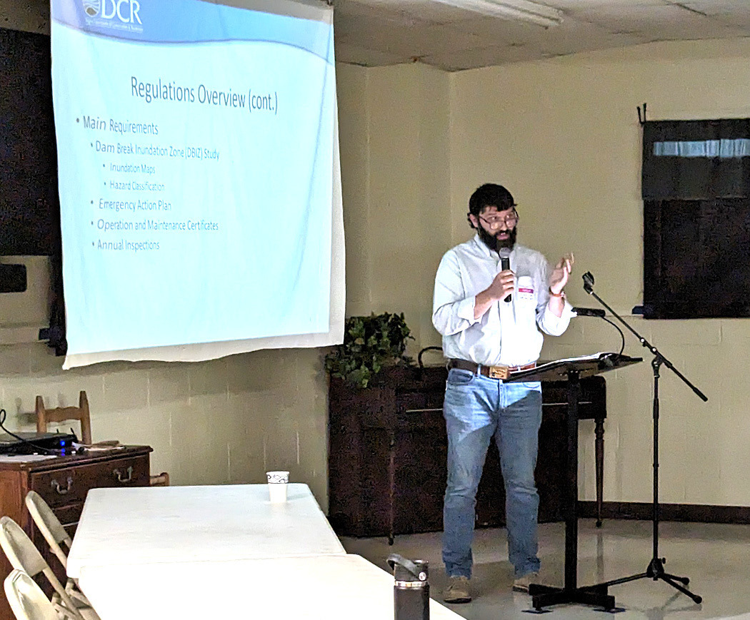
Flooding of the Maury is not outside the realm of possibility. In 1985, the river flooded, resulting in the road through Goshen Pass being closed for a year for repairs. There have been other serious instances that have raised concerns over the years. In 1993, discharge from the dam resulted in a fish kill in the river and, most recently, draining of the lake in August of 2023 resulted in a large discharge of sediment into the river, garnering the attention of many residents along the Maury River. The Maury River Alliance was formed in response to last August’s draining. -Justin Deel, a DCR regional dam safety engineer who is responsible for overseeing the Goshen dam, spoke on the process for dam certifications and the current status of Goshen’s certification. Most dams have a certification that is renewed every six years unless serious issues are found during inspections. As a high hazard dam, the Goshen dam is inspected every two years. If issues are found, a conditional certificate can be issued, which will allow the dam to continue to operate while the issues are addressed.
The Goshen dam currently has a two-year conditional certificate which is set to expire in July.
Most of the issues that warranted the conditional certificate have been addressed, with two still outstanding – a plan to fix the low-level drain, which has become clogged due to sedimentation buildup, and to host an emergency plan table top exercise. The Boy Scouts of America (BSA) have until July to complete those two conditions in order to receive a regular certificate.
In response to a question from the audience, Deel explained that, if the BSA has not completed those conditions by July, but are able to show that they can get them completed in the near future, a one-year conditional certificate could be issued.
Deel also explained the rating system for dams in Virginia which has four tiers: satisfactory, fair, poor and unsatisfactory.
The Goshen dam currently has a fair rating, which means that “no existing dam safety deficiencies are recognized for normal operating conditions,” but that “rare or extreme hydrologic and/or seismic events may result in a dam safety deficiency.” In the case of the Goshen dam, Deel said that the rating was largely based on the low-level drain not currently being operational and that once that was addressed, he felt that the dam would be rated as satisfactory.
-One of the major concerns that was raised by McClung and other county residents who live along the river was the alert system that was in place in the event that of a dam breach, whether a full breach or a partial one. The current alert system is a notification that comes to people’s cell phones.
Dr. Linda Larsen, who spoke later in the forum, suggested a siren warning system. No specific solutions were settled on, but it was one that Larsen encouraged people to speak to their government representatives about, along with the concentrations of sediment released into the river. -On the issue of sediment in the river, the audience heard from Stan Ponce, a county resident, who spoke on the Clean Water Act, and its provisions for addressing pollutants in rivers like the Maury and Little Calfpasture.
Ponce noted that there are two types of pollution that the act addresses: point and nonpoint pollution. Point pollution is pollution that comes from a single source and enters a river at a single point, such as runoff from a factory, while non-point pollution is pollution that doesn’t have a singular source and is primarily caused by storm runoff or snow melts carrying pollutants into the waterways.
The sediment that gets into the Little Calfpasture River and Lake Merriweather and is ultimately released into the Maury River comes primarily from runoff throughout the Little Calfpasture’s watershed, and is therefore nonpoint pollution.
When the Clean Water Act was passed in 1972, it primarily addressed point pollution sources, but amendments in 1987 sought to address non-point sources. The primary solution for addressing non-point pollution is to set a Total Maximum Daily Load (TMDL) of pollutants.
“A TMDL is essentially a pollution budget – a quantitative estimate of what it takes to achieve state water quality goals, setting the maximum amount of pollution a water body can receive without violating water quality standards, including the margin of safety,” Ponce explained. “As such, TMDLs provide a scientific calculation of how much pollutant loads need to be reduced to meet those standards.
“The goal of a TDML is to eliminate an impairment, not meet a pollutant limit just for its own sake,” he added.
In this case, the impairment applies to the section of the Little Calfpasture River between the dam and the Maury River. The .8 mile segment of river was determined by the DEQ to be impaired following an assessment in 1996. The assessment determined that that section of the river was a benthic impairment, meaning that it “does not support a healthy and diverse community of bugs and fish.”
In 2010, the DEQ began conducting studies of the river with the goal of setting a TMDL for the Little Calfpasture River to eliminate the impairment. In 2017, work began on developing an implementation plan for the TMDL.
Nesha McRae, the TMDL coordinator for the DEQ’s Valley Regional Office, spoke on the results of the studies of the sediment levels in the lake and the river, as well as the goals for the TMDL implementation plan.
The study found that while all of the sediment that makes its way into the impaired section of the Little Calfpasture and then the Maury comes from Lake Merriweather, only around 6 percent of it originates from the lake.
The vast majority of it is coming from the land upstream of the lake. The majority of it (52 percent) comes from degraded riparian pasture, or pastures that borders either the Little Calfpasture River or one of its tributaries, where livestock have access to the water. Another 28 percent of the sediment comes from runoff from over-grazed pastures within the watershed, 12 percent comes from runoff from forested areas and the remaining 8 percent is from other sources along the watershed.
The study also found that 25 percent of the sediment that flows into Lake Merriweather during storms gets trapped in the lake and is slowly released downstream, resulting in periods of turbidity, or cloudiness, downstream of the dam that last up to eight days, which is four times longer than the turbidity upstream.
“With aquatic life, they can sustain a day or two of highly turbid water, but eight days is repeatedly going to be too long to support healthy aquatic life in the river,” McRae said.
The draining of the lake was also found to have an impact on the amount of sediment in the river. The lake is lowered during the winter, and a study conducted by James Madison University in 2022 and 2023 found that the concentrations of sediment were 25 times higher downstream than upstream of the dam when the lake was lowered in the winter. It also found that the sediment concentrations in the winter were 6.5 times higher than when the lake was full in the summer.
The implementation plan set a goal for a TMDL of 1,198 tonnes (metric tons) of sediment per year, or 3.28 tonnes per day. The 10-year plan calls for at least a 40 percent reduction in each of the sources of sediment upstream of the lake and a 34 percent reduction in the sediment from Lake Merriweather itself.
For the non-point sources upstream, the plan calls for almost 20 miles of livestock exclusion fencing, 3,000 acres of improved pasture management and 80 acres of streamside buffer plantings to help reduce sediment runoff.
For Lake Merriweather’s draining, the DEQ worked with the BSA to develop target depths to drain to and a maximum time period for drainage. For dry weather, the target is a depth of 5.5 feet for no longer than four months and for wet weather, the target depth is 7.5 feet for no longer than three months. There is also consideration being given to some planting in the areas that are exposed when the lake is lowered or other steps to limit runoff.
“If this were followed, along with some of those other targets in terms of agriculture best management practices, our estimates show that we will get to a level of sediment that was tolerable for life in the Little Calfpasture River,” McRae said.
McRae told The News-Gazette in an email Tuesday that since the implementation plan was completed, a total of 3.6 miles of livestock exclusion fencing has been installed through this program (19% of the fencing goal), in addition to 15.2 acres of streamside buffers (19% of the buffer goal) and 315 acres of pasture management (10.5% of the improved pasture management goal). At the forum last week, McRae mentioned that the Headwaters Soil and Water Conservation District recently received grant funding for implementation of a best management practices project that included funding for 45,000 feet of livestock exclusion fencing at the Augusta County Correctional Center’s farm, which is in the watershed for the Little Calfpasture River. The 8.5 miles of fencing would constitute half of the target for the fencing goal.
For more information about the Maury River Alliance, its goals and how to get involved in local efforts regarding the river, email info@mauryriveralliance. org.