
Correspondent Shares Family Photographs
Having passed the 40th anniversary of the “Election Day Flood” of 1985 just four months before, another significant flood anniversary arrived last month. Among early 20th century benchmarks on the upper James, it remains to this day in the top five of the river’s worst floods.
Ninety years ago last month, the James River became a roaring, indomitable force that swept across southern Rockbridge County. What began as a local disaster became part of a larger story: a storm system that produced catastrophic floods from New England to Virginia, prompting federal action on flood control that shaped the region for decades.
In March 1936, weeks of cold rain fell on frozen ground, causing widespread snowmelt over much of the Mid-Atlantic. From March 17 to March 19, the river surged beyond its banks, covering farmland, rail lines, and homesteads from Buchanan to Lynchburg. During the flood’s peak, water levels were recorded as being in major flood stage from Covington to Richmond. The highest crest near Rockbridge was recorded by the Holcomb Rock gage at 30.78 feet. The average gage height at that location today is 3 to 5 feet.
The Lexington Gazette of March 1936 described railroad tracks at Natural Bridge Station “under several feet of water.” Farms along the river lost livestock and fences. When waters receded, layers of silt covered crops and fields that would not recover for years.
At Greenlee in Natural Bridge Station, three photographs taken by local families of the river as it flooded were passed on to Hallie Williams, whose home from 1957 until her death in 2019 is visible in one of the photographs. Hallie was my great-grandmother and the photographs were passed on to me. Labeled simply as “Flooded James, March 1936,” these surviving images offer a striking view of that historic flood.
In one, the swollen river spreads across bottomland at the north entrance to Arnolds Valley, with the ridgeline along the western side of Thunder Hill looming in the misty distance —wherein, years later, the highest point of the Blue Ridge Parkway in Virginia would be prominently visible from the valley below.
Another shows the singlelane bridge that connected Arnolds Valley to Greenlee Road with its stone piers nearly submerged at the time the photograph was captured. This bridge was later replaced in the 1960s by the higher, two-lane Charles F. Campbell bridge, still in use today.
In the third photograph, the churning rapids rage downstream, passing Virginia Manor on its way towards Glasgow through the riverine woods that so thickly lined that section of the river in those days.
The effect of this flood in Rockbridge was not confined to the James River alone. The Maury River also swelled dramatically. Official gage data shows a crest of 22 feet on March 18 at Buena Vista. Rail trestles, mills and riverside infrastructure in Lexington and Buena Vista were inundated as the floodwaters surged. The dual impact of the James and Maury rivers makes this flooding event a defining moment in the hydrologic history of Rockbridge County.
The U.S. Geological Survey later called the 1936 deluge one of the most destructive floods in James River history, documenting the event’s severity in “Floods of March 1936, Part 3 (Potomac, James & Upper Ohio).” The flood was the river’s second worst recorded; a mere 6 inches shy of the standing record at the time. According to the National Weather Service’s data from the Holcomb Rock gage, the James River crested at 31.3 feet during the 1913 flood, 113 years ago – also, last month.
The floods of 1913 and 1936 remained the James River’s top two worst floods until the devastation wrought by Hurricane Camille in 1969, during which the James crested at Holcomb Rock at 35.5 feet. The 1913 and 1936 records were surpassed again by flooding from Hurricane Agnes in 1972 with a crest of 32.38 feet and again in November 1985 with an unimaginable crest at Holcomb Rock of 42.15 feet.
Old photographs like these from the 1936 flood endure not just as family keepsakes, but as windows into our landscape’s past — ancestral reminders, though sometimes haunting, of how the usually quiet flow of the beautifully scenic James and Maury rivers can and will, under the right conditions, transform into something truly unforgettable. For Rockbridge County, these floods marked defining events — proof of the power of the James and Maury rivers, as well as our community’s resilience.
Editor’s note: Karyn Gardner is the Arnolds Valley correspondent for The News-Gazette.
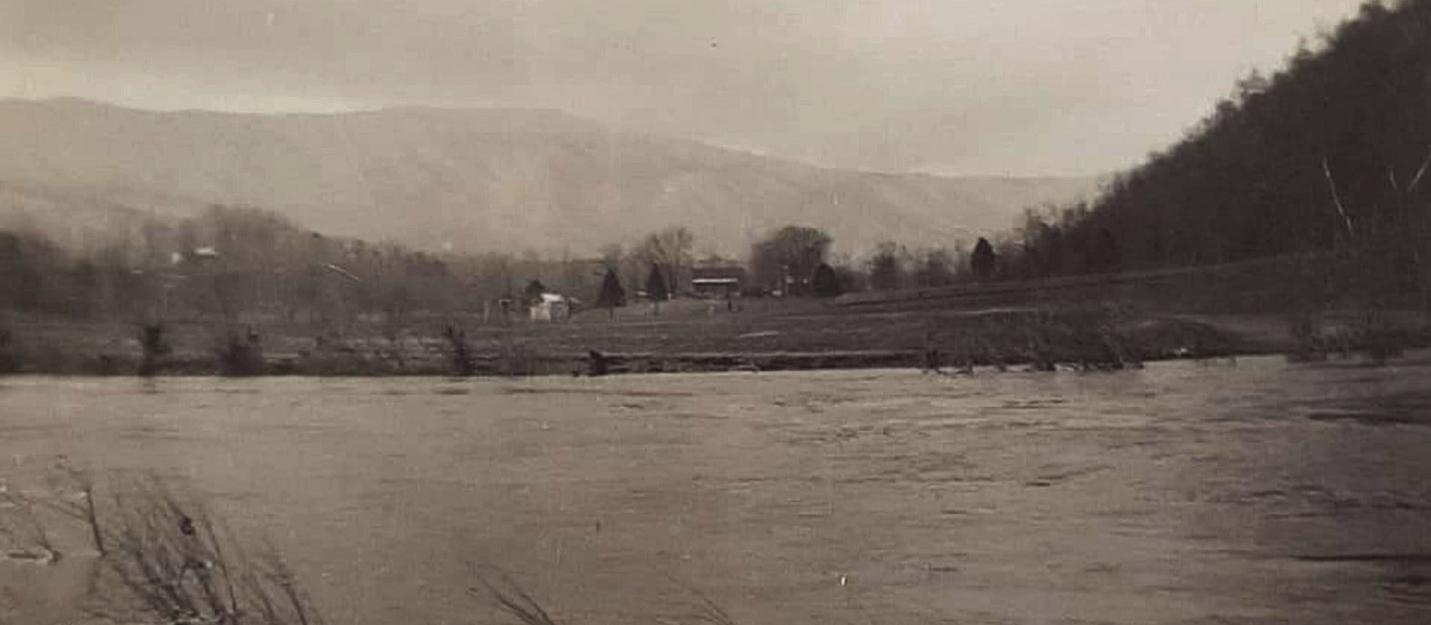
THE JAMES RIVER spreads across bottomland at the north entrance to Arnolds Valley during the flood of 1936.
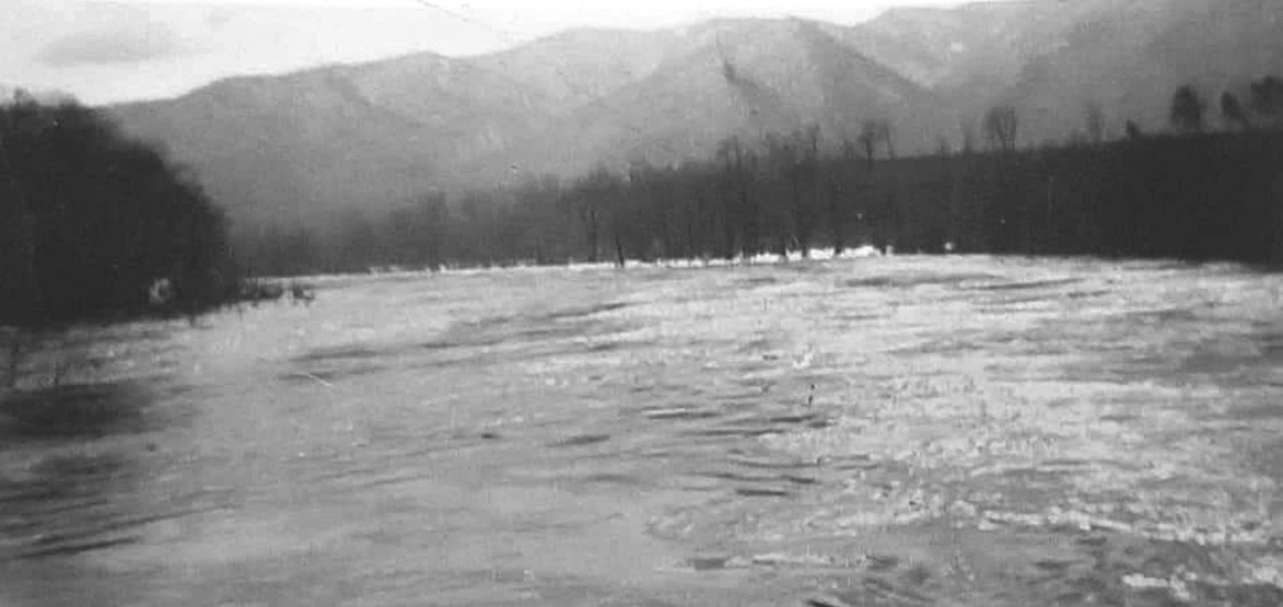
AMONG the photos of the flood of 1936 in the possession of the late Hallie Williams was this view of the James River passing Virginia Manor on its way to Glasgow.